Recent Projects
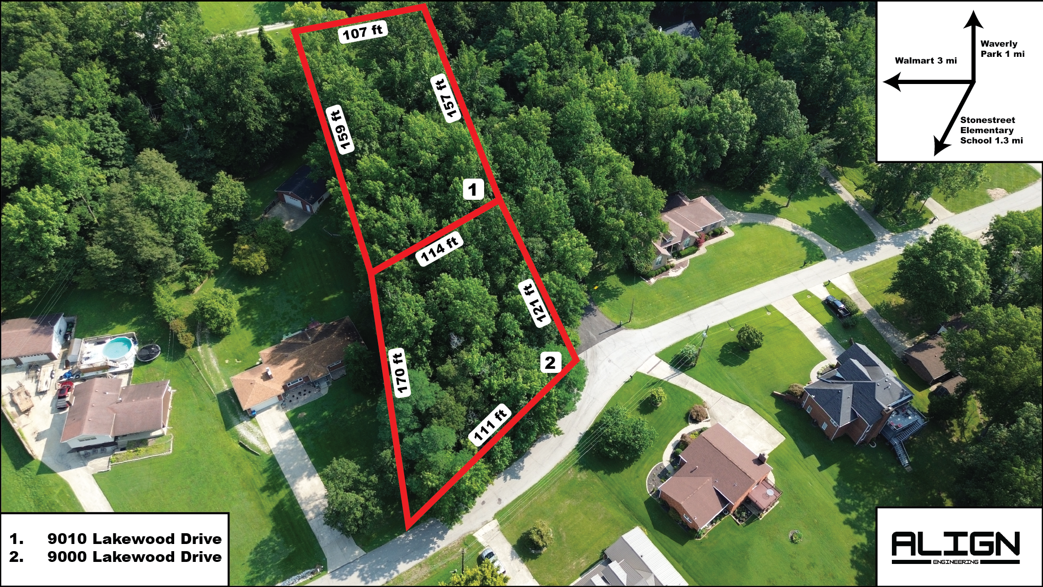
Lakewood Drive
Real estate aerial scan of a residential property at 9010 Lakewood Drive, showcasing property features and boundaries for listing purposes.
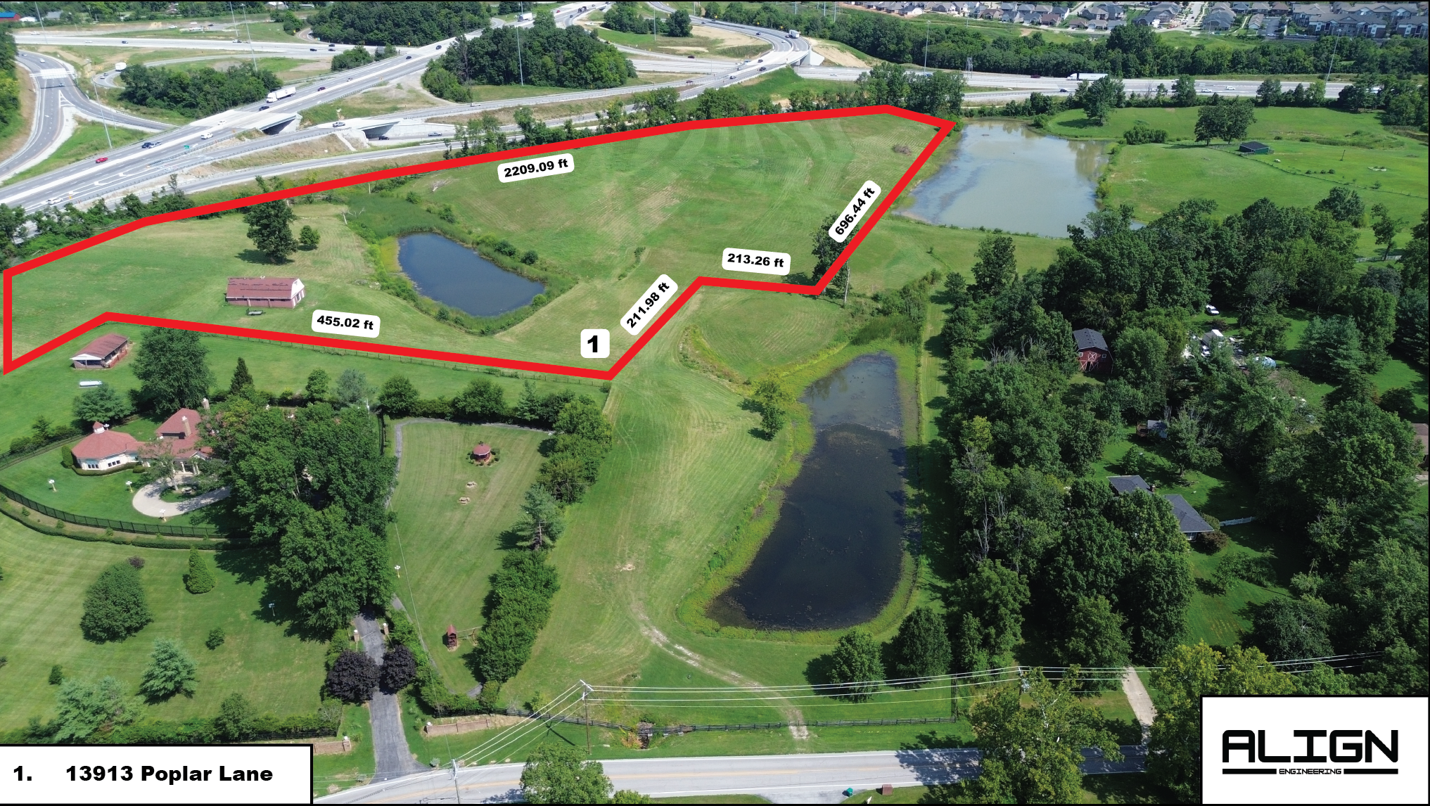
Poplar Lane
Real estate drone scan of 13913 Poplar Lane, providing high-quality aerial views for property marketing and real estate listing enhancement.
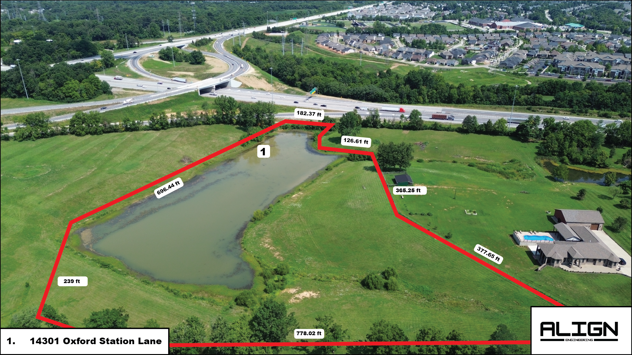
Oxford Station Lane
Real estate aerial scan of 14301 Oxford Station Lane, capturing property views and surrounding landscape for real estate marketing materials.
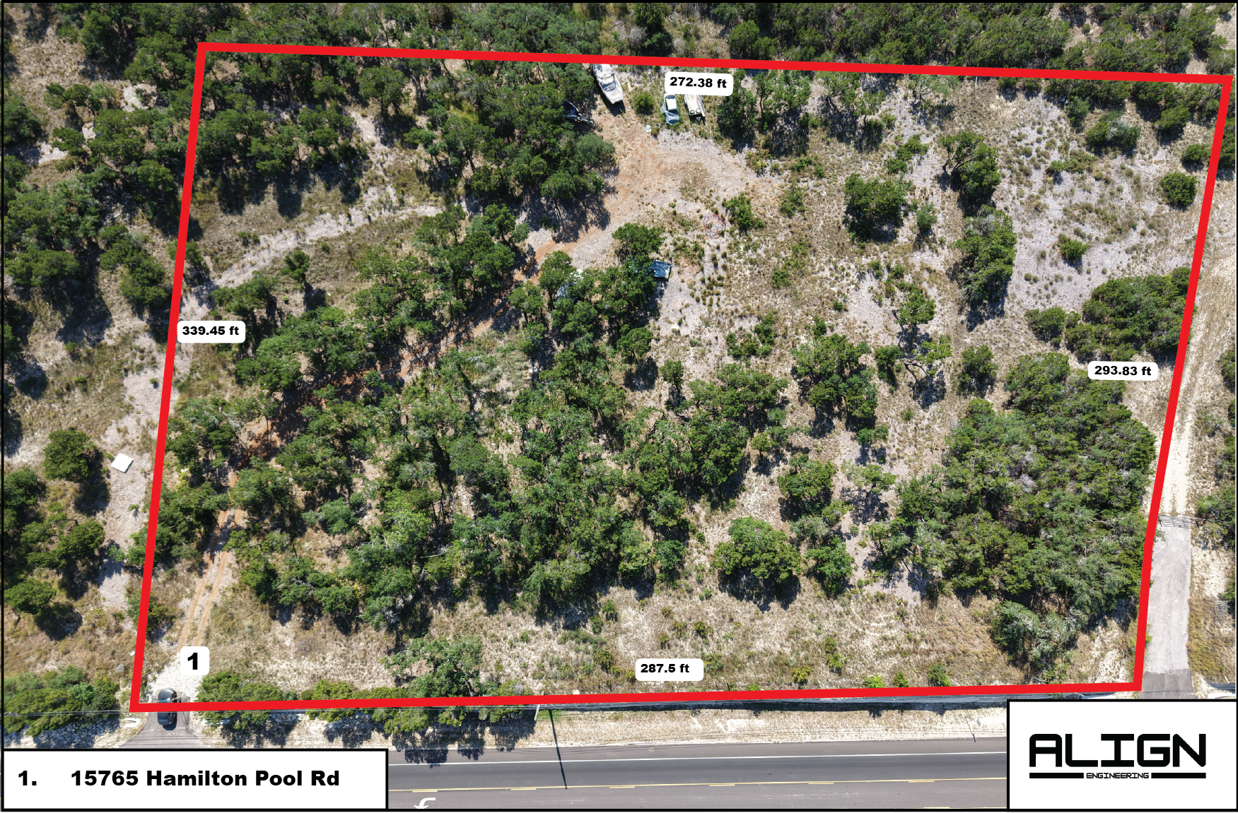
Hamilton Pool Road
Real estate drone scan of 15765 Hamilton Pool Road property, highlighting the expansive layout and features for potential buyers and real estate listings.